AIS Kystverket -
Viewing Ship Position from NCA's AIS Network.
Version 1.1: Bugfixes
- Improved stability when networks are not available
- Solved problem with Android 4.4 and newer where the WMS team does not appear.
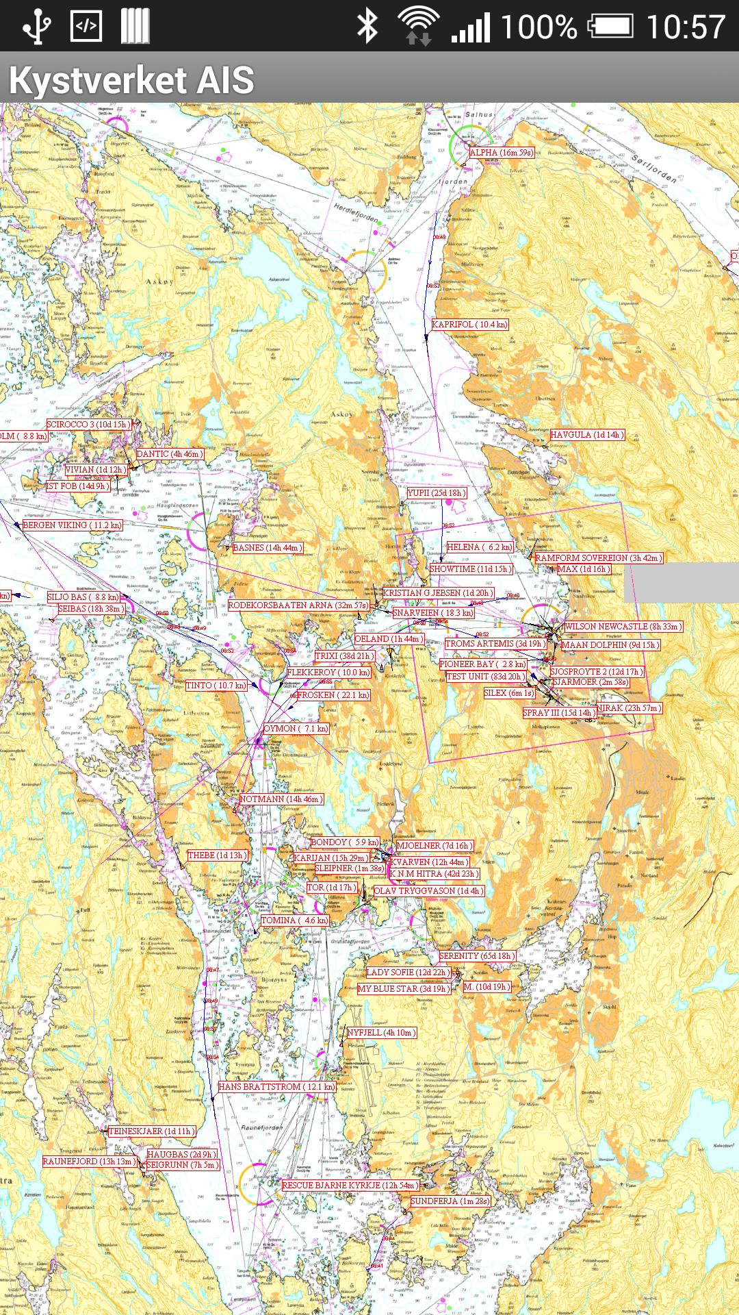
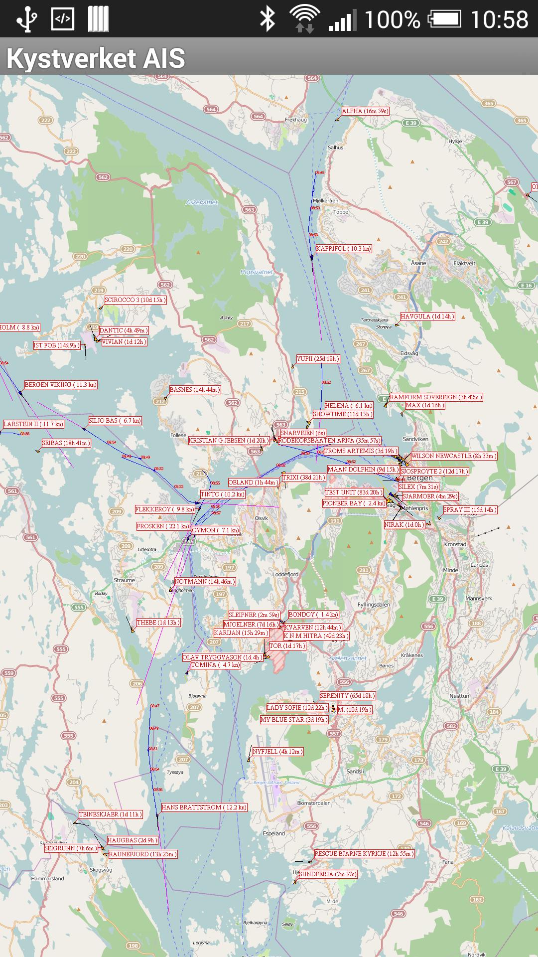
This app shows ships from the Norwegian Coastal Administration AI's network with maps from the Norwegian Mapping Authority and Open Street Map.
In order to view AIS data, you must have an account with the Coastal Administration's "Aisonline" service and this must be set up to be able to download configuration file for the app. The teams set up on "Aisonline" are also available in the app.
The app has the following features:
- Map view of AIS data with standard map functionality
- Bookmarks. Save bookmarks to be able to move to an area quickly
- Search for ships with name or call signal. Phones with own search button can use this one
- Long press the position of the ship in the map provides more info about the ship
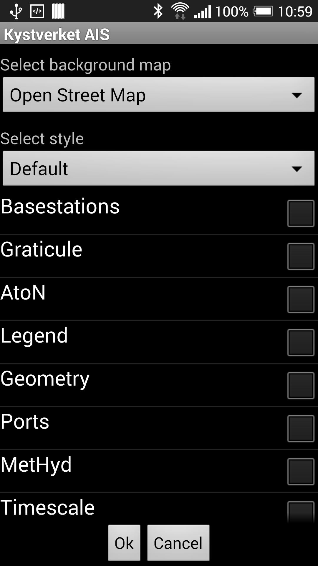
- Map setup. Select background map, presentation (style) and which teams to appear
Information on how the app is configured can be found on the website:
http://www.skystverket.no/maritime services/meldings- and- information services/automatatically-di-
Upgrading from earlier version 1.0: Version 1.0 must be manually uninstalled before installing version 1.1. This is done by entering Settings -> Applications, finding "The Coastal Administration AIS" and clicking on Uninstall or Uninstall.